“The opportunity to work with Omanos on ground truthing of satellite data around the major geothermal sites in Kenya’s Rift Valley has been of significant benefit for local communities and expanded the skills and experience of field researchers for future projects.”
The focus of gEOthermalKenya was to enhance the uptake of satellite EO data for Kenya’s Environmental and Social Impact Assessment (ESIA) processes, through engagement with stakeholders in the country’s expanding geothermal energy sector.
Omanos and Edinburgh-based partner GSI engaged with several Kenyan government authorities (including the National Environment Management Authority and the Kenyan Space Agency) to identify the in-country requirements and opportunities for inclusion of satellite data approaches. The ultimate goal was to facilitate the environmentally, socially and financially sustainable growth of this important green energy sector.
A broad range of techniques were employed to evidence impacts at existing sites including the relocation of indigenous communities (both voluntary and forced), livelihood changes, access issues and land-use changes. In addition, local communities were engaged via interviews, participatory mapping and water/soil sampling in order to capture their experiences and perceptions living with the nearby geothermal sites. This was done by local community representatives from the Maasai tribe, in collaboration with the British Institute in East Africa’s Procol Kenya initiative.
The project highlighted the potential for satellite EO and local community intelligence to retrospectively understand problems at existing facilities and for baseline monitoring and mitigation at future geothermal sites.
You can find out more on our IPP Project Blog.
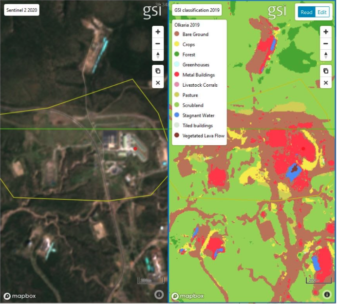
Land classification of olkaria v by omanos and gsi, overlaid against sentinel 2 satellite imAGERY


