EO analysis for social justice & accountability
“The report was extremely helpful and featured prominently […] It really came through as incontrovertible evidence to refute the company’s bogus claims about Area One being tree-less. The community was thrilled about having and presenting these images and analysis. The company representatives just sat there fidgeting, knowing that there was nothing they could say. Thank you so much for your assistance.”
Omanos Analytics worked with US-based NGO Inclusive Development International to demonstrate the power of satellite imagery in supporting community narratives.
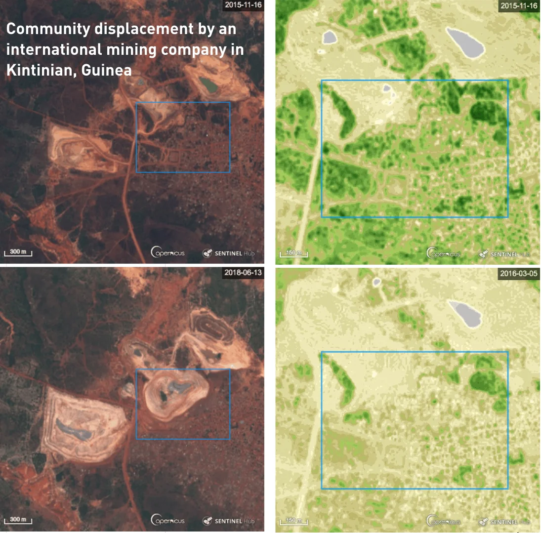
IDI’s team of lawyers was supporting local communities to submit a formal complaint with the World Bank’s private-sector arm, the International Finance Corporation (IFC), following their forced relocation to make way for a gold mine expansion. Conflicting accounts from the gold mining company and the local communities focused on the living conditions at the resettlement site and those at the original site. This included community claims that they had gardens and trees, something the company
Omanos used Sentinel 2 imagery to evidence the existence of vegetation at the site during the wet season, validating the community’s eyewitness testimony. The satellite data analysis, presented in the form of an image-based slide deck, provided a key source of new evidence to move the arbitration process forward.


