Perspectives: Operationalising Women’s Lived Experience of Climate Change through Geospatial Photography in Kenya
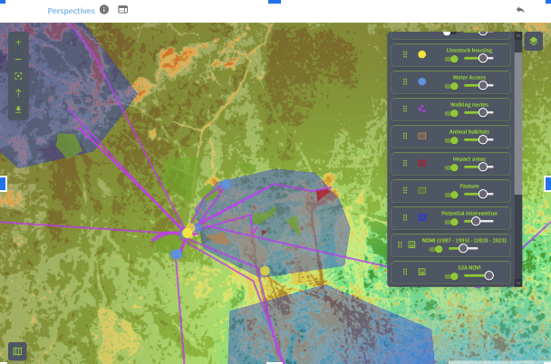
In March 2024, we wrapped up a pioneering programme in Kenya to improve local climate responsiveness by bringing in additional “perspectives” on both the problem and the solution. We partnered with Nairobi-based Lensational, which trains women from underrepresented groups and communities to use visual storytelling, especially photography. Our goal was to integrate geospatial photography and groundtruth data by Maasai women with remote sensing and GIS data, in order to provide a more comprehensive and nuanced picture of climate impacts on the ground. We wanted to bring community members to the fore in designing and proposing solutions that were rooted in their lived experience - and validated through satellite data analysis.
Lensational used Omanos’ smartphone app to record ground data that was supplemented by community-led photography, in order to reveal the climate impacts faced by women along with unique insights into land use and related social challenges. Targeted analysis of areas covered by the ground-truth data and community narrative was done using Sentinel 2 imagery dated shortly after the fieldwork was performed. We also used Landsat imagery over 30 years, between 1987-95 and 2020-23, to validate historical accounts from the communities. We identified four priority areas for action, each tied to a specific geographical area
tree planting;
terracing and flood management;
new dams and water points; and
climate resilient agriculture practices (boreholes & irrigation; subsidised seedlings; drought resistant crops).
These insights will feed into climate resilience strategies in Kenya, ensuring that the lived experiences of women are represented in long term sustainability planning. We are grateful to the UK Space Agency for supporting this work.


